

Underground service locating is the important process of identifying the location and depth of underground utilities and infrastructure, such as gas lines, water pipes, electrical cables, telecommunication lines, sewer, or stormwater drainage pipes.
Our accredited team uses advanced technology and techniques to detect underground utilities, ensuring compliance with industry standards.
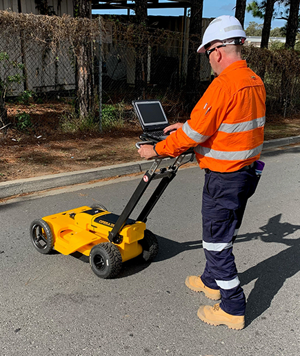
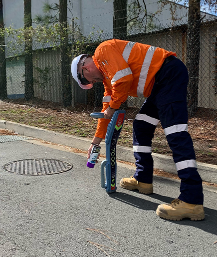
Service Locating is an essential process that utilises advanced techniques like EMI (Electromagnetic Induction) and GPR (Ground Penetrating Radar) to accurately locate underground utilities and infrastructure. By employing these methods, our Service Locators can identify the presence and location of buried cables, pipes, and other subsurface assets.
Request a quoteThe use of EMI allows service locators to detect the electromagnetic signals emitted by buried utilities, providing valuable information about their depth and position. GPR uses radar pulses to create detailed images of the subsurface, revealing the presence of both metallic and non-metallic objects.
Our comprehensive services include accurate surveying and mapping, ensuring the highest standards of compliance and Australian Standard Compliance.
With the help of these technologies, service locators can deliver high-quality reports that include comprehensive information about the location, depth, and type of underground utilities. These reports are crucial for various industries, such as construction, engineering, and infrastructure development, as they ensure the safety and efficiency of excavation and construction projects.
By combining EMI and GPR, our Service Locators can accurately map out the underground landscape, facilitating informed decision-making and minimising the risk of damage to existing utilities.
Map your critical underground assets to keep an accurate record, and inform you of any future work and avoid putting these assets at risk.
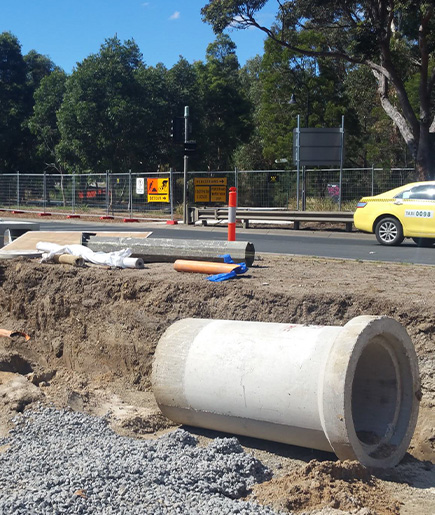
Utility mapping is crucial for creating detailed maps or plans depicting underground utility infrastructure, such as water, gas, electrical, and communication lines.
Without being able to see them, buried utilities are at risk of damage or undiscovered faults. Utility locating and mapping gives you the advantage of visibility, allowing you to avoid damage occurring, and to investigate any existing damage or faults.
It is crucial to locate gas pipes to prevent hazardous occurrences on construction sites.
With your underground utilities located and mapped, your projects can proceed without the costly delays of discovering and/or damaging undiscovered services.
Accurate information is crucial for creating a safe construction site, ensuring that all potential hazards are identified and managed before any work begins.
The mapping and pre-excavation plans provided as part of our utility location services equip you and your contractors with everything you need to know to plan and future construction or site excavation.
Locating underground services is imperative for planning and executing excavation work safely and efficiently to protect workers, the public, and the environment.
Our underground utility locating services can detect:
We also use advanced technology to locate metallic pipes, ensuring comprehensive detection of all underground utilities.
All of these details will be noted in your location report, along with the location of utilities, the utility type, and the depth of the utility from the surface.
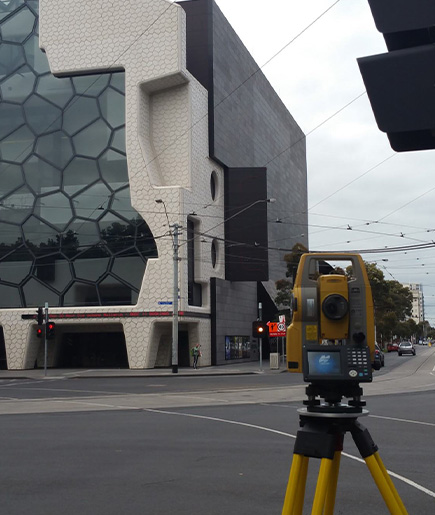
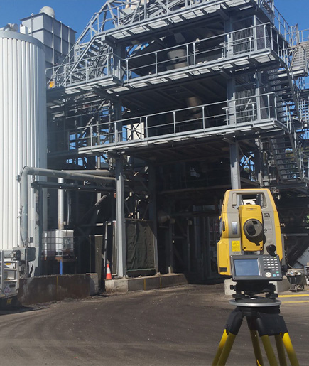
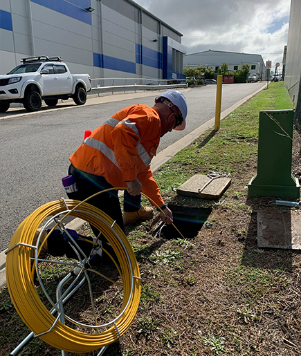
Our experienced service locating crews use the latest technology, finding and tracing assets efficiently, and quickly identifying anything that needs further investigation. Our team uses three primary methods of electronic service locating:
Locating utilities enhances safety and efficiency, ensuring compliance with regulations and reducing costs in construction and excavation projects.
When the location of a pipe or cable needs to be determined before its depth and alignment are evaluated, several techniques can be used to access confined spaces or underground chambers:
We use high-quality, accurate GPS systems, with a typical accuracy of 10-20mm horizontal and 15-30mm vertical, and have our own web-based GIS portal
Our GPS systems are survey-grade units. We use the best Virtual Reference Station (VRS) networks and are able to set up our own local base stations for rural applications where coverage is limited. Robotic total stations are available for locations where satellite coverage is an issue.
UtilityTrack is an asset management tool providing an effective way of tracking, analysing and reporting on scheduled maintenance works, enabling transparency between us. Displayed with a GIS view, UT showcases the asset/pipe network over a choice of base maps including property boundaries and aerial photos.

TDG Environmental is the most experienced provider of sustainable waste and stormwater management solutions throughout Australia and New Zealand specialising in a comprehensive range of environmental services including:
The Utility Track software is designed to offer our clients an effective solution for managing, storing, backing up, and sharing stormwater and sewer data collected during work.
read moreOur utility location services give you full visibility of any and all utilities located below ground level with minimal site disturbance.
read moreNon-Destructive Digging (NDD) or Hydro Excavation is also known as Vacuum Excavation, Potholing, Hydro Excavation, Hydro-Trenching, and Non-Invasive Digging and is a preferred method of bulk excavation for construction.
read moreDrain, pipe and culvert cleaning is the process of removing accumulated materials from pits, pipes, drains and culverts to ensure smooth water flow and prevent blockages.
read moreA GPT is a device designed to capture and retain large solid waste and debris. Regular cleaning and maintenance of GPTs are essential to ensure their effectiveness in preventing pollution.
read more
We can vacuum large amounts of waste and debris, using a combination of vacuum trucks and vacuum tankers allows us to remove and dispose of waste quickly and efficiently.
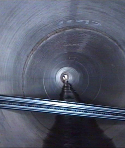
read moreThe internal inspection of an underground pipe using robotic CCTV, and other sensor technology such as sonar and laser, to ensure the conduit has structural integrity and is performing as designed.
read moreRepairing or restoring existing pipelines to extend their service life or improve their performance using tried and trusted techniques and technologies.
read moreSpecialised waste vehicles purpose-built to transport substantial volumes of waste efficiently and safely.
read moreOur spot spray applicator is designed and built to target areas directly affected by tree root intrusion in your sewer system.
read moreOur innovative dredging systems enable the continuous removal of sludge’s, biosolids and other materials water bodies.
read moreTDG Environmental provides reliable grease trap pump-outs, cleaning and management services that keep your commercial kitchen compliant, odour-free, and running smoothly. Our EPA-licensed team ensures proper waste disposal while protecting your plumbing and the environment.
read moreTrenchless pipeline rehabilitation provides our clientele with an innovative and cost-effective option for repairing pipe defects at a fraction of the cost of excavation and open cut replacement.
read moreTDG conducts smoke testing services as a method in locating illegal stormwater connections and infiltration/exfiltration of sewer assets. TDG offers smoke testing for both mainline and domestic sewer and stormwater services.
read moreFast, reliable septic tank pump out services across the Ballarat and Geelong regions. TDG Environmental delivers EPA-approved septic waste removal with 30+ years of experience, advanced vacuum truck technology, and same-day emergency response available.
read more


 Australia 1300 330 294
 AU 1300 330 294
  info@tdg.com.au


